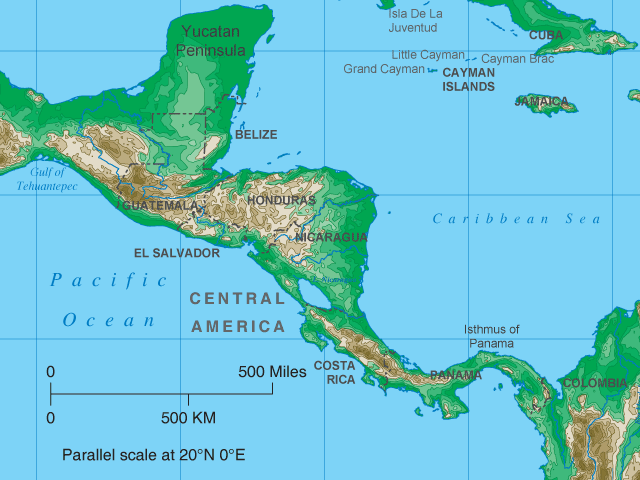
Central America map  

Central America Topo Map


Central America Map > Topographical Map • Travel & TourismAbout Us

The highest point in Central America is Guatemala's Volcan Tajumulco, which rises to an elevation of 13,816 feet, or 4,211 meters.  This Central America topographic map depicts the elevations of land areas in the Central American region.  Colors ranging from green to brown are used to show elevations, as indicated on the elevation chart below.

central america topographical map

Map Elevation Chart

central america map elevations


Copyright © Central-America-Map.com.  All rights reserved.

Central America Topo Map - Central America Topographical Map